Live from NOAA’s GOES satellite

Every lightning
strike. Live.

Lightning Tracker plots every strike on a real-time map within seconds of it hitting, refreshed every 20 seconds. Then it sends a push notification the moment lightning enters the radius you care about.

Download on the App Store
Map refresh
20sMap refresh
Max alert radius
186miMax alert radius
Storm rewind
24hStorm rewind
Lightning Tracker on iPhone, showing live lightning strikes north-west of Nashville with an alert radius ring and a banner reading Lightning within 31 mi

How it works

How the live lightning map works

From the flash to your phone in about a minute.

  1. 01

    The satellite sees the flash

    NOAA's Geostationary Lightning Mapper rides on the GOES-19 satellite, 22,000 miles up, watching the whole hemisphere for the optical flash of lightning. It publishes a new batch of detections every 20 seconds.

  2. 02

    Our servers match it to you

    Each batch is ingested within seconds, plotted onto the map, and checked against every watch radius people have set, including yours.

  3. 03

    Your phone tells you

    If a strike lands inside your radius, a push notification goes out immediately, with the distance and direction. You do not need the app open.

Satellite detection covers the GOES-East footprint: the continental United States, southern Canada, Mexico, Central America, the Caribbean and most of South America. It locates a flash to within roughly 5 to 10 km. That is the precision that matters for deciding whether to clear a field, not for surveying a strike point.

What you get

A storm radar that tells you when to move

Six views of the same storm: where lightning is striking now, where the rain is, where the cell is heading, and what it already did.

Live strike map

Every strike, the moment it lands

Lightning Tracker turns NOAA's GOES weather satellite into your personal storm warning system. Strikes appear on the map within seconds, refreshed every 20 seconds, so you watch storm cells form, move and fade in real time.

  • Every strike plotted live from NOAA's GOES lightning sensor
  • Color-coded by age, so you see where the storm is right now, not 15 minutes ago
  • A nearest-strike card showing exact distance and which way it is tracking
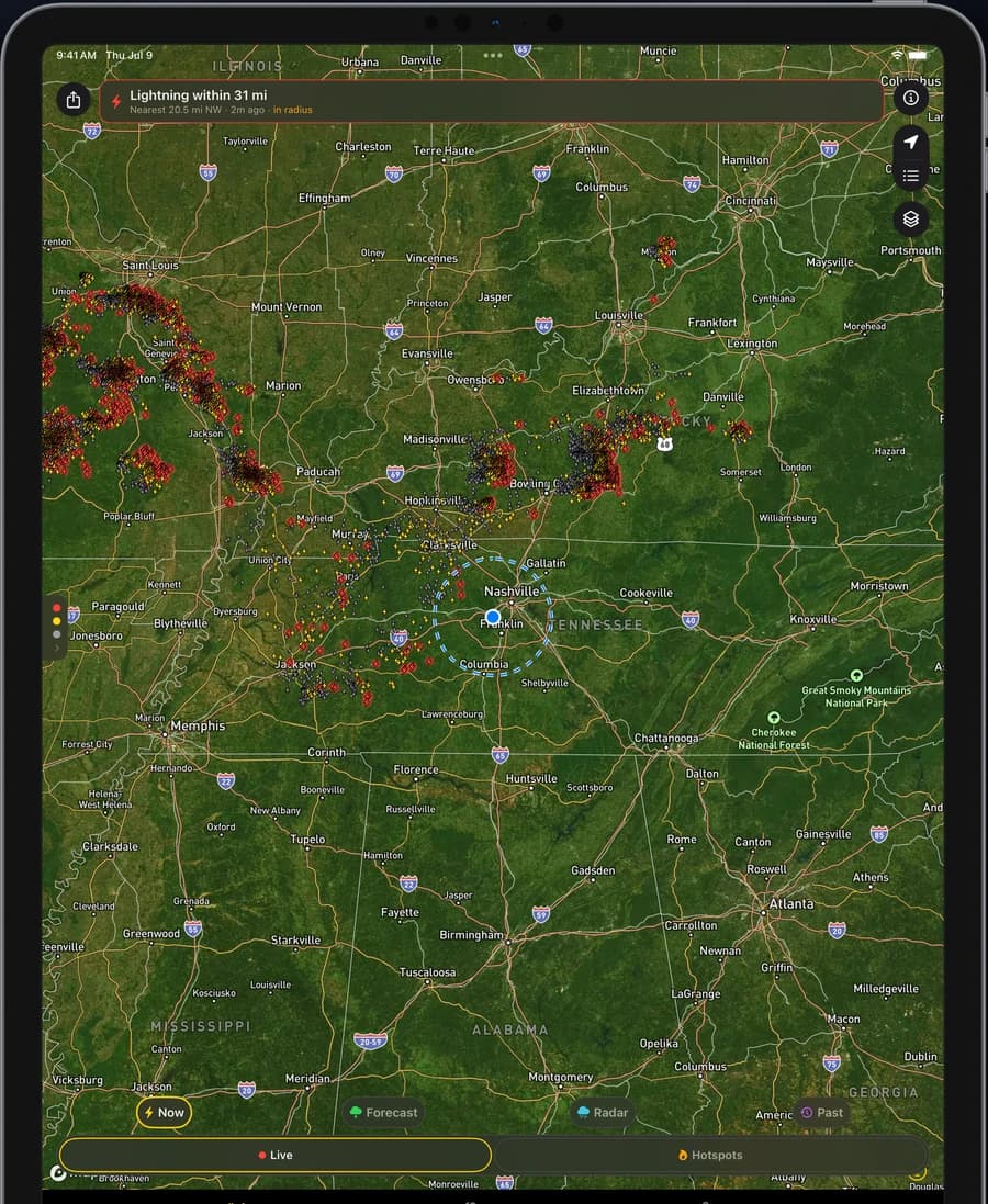
Lightning Tracker running on iPad, showing the live strike map with color-coded lightning strikes around an alert radius ring

Proximity alerts

A push before the storm is overhead

Set an alert radius and get a notification the moment lightning strikes inside it. Alerts keep working when the app is closed, so the first thing you hear about a storm is your phone, not the thunder.

  • Notified the instant lightning enters your radius
  • Watch several places at once: home, the cabin, the ballpark
  • Works with the app fully closed
A lightning proximity alert notification on the iOS lock screen reporting a strike inside the user's watch radius

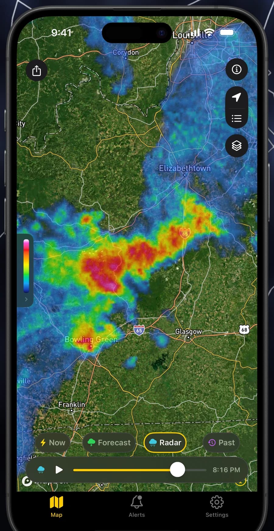
Radar

See the rain that rides with the strikes

Precipitation radar layers underneath the strike map, with two hours of playback you can scrub frame by frame. Watch the cell approach and judge whether it passes north of you or straight over you.

  • Two-hour precipitation playback, frame by frame
  • Radar and lightning on one map, not two apps
  • Built on NOAA MRMS, updated every two minutes
Precipitation radar playback layered beneath live lightning strikes in Lightning Tracker

Storm rewind

Scrub back through 24 hours

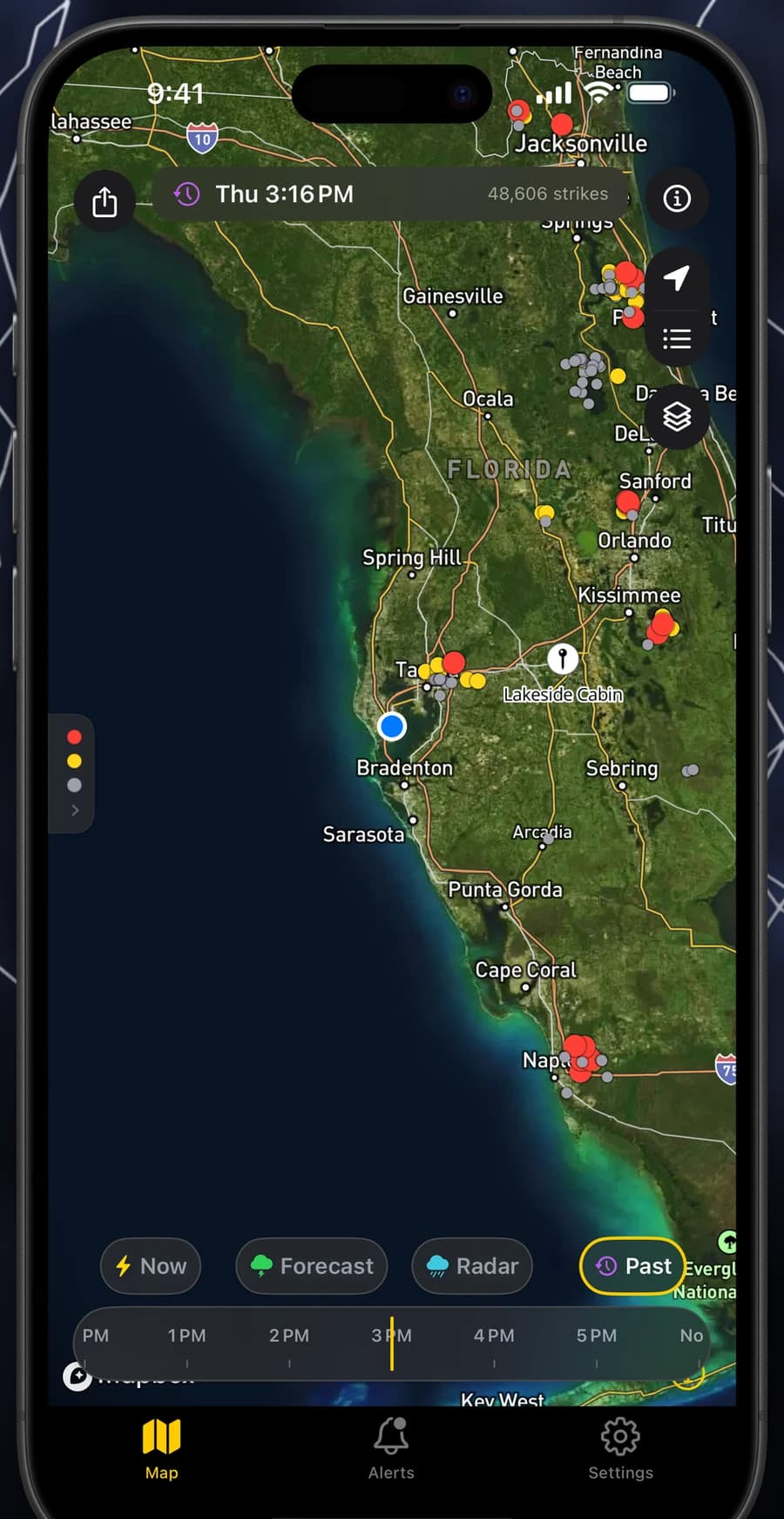
Storms do their most interesting work while you are asleep or indoors. Rewind a full day of lightning hour by hour to see exactly where last night's storm tracked, and whether it came down your street.

  • 24 hours of lightning history, hour by hour
  • Confirm what actually hit a property or job site
  • Replay a cell's whole track from first strike to last
Lightning Tracker's 24-hour storm rewind timeline replaying a past night of lightning strikes

Hotspots

Watch storm cells form

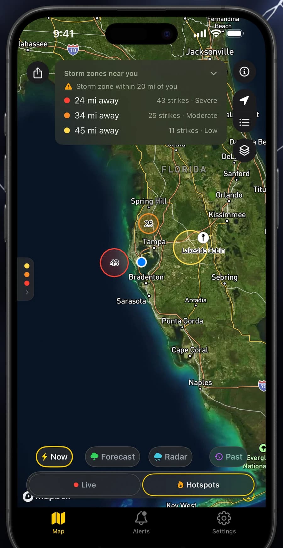
Raw strikes tell you where lightning hit. Hotspots tell you where the storm is. Live clusters of concentrated activity are ranked by intensity and by how far they are from you.

  • Active storm zones, not a static density map
  • Ranked by intensity and distance from your location
  • Spot a cell building before it reaches your radius
A ranked list of active lightning hotspots showing storm intensity and distance from the user

Severe outlook

Know the risk days ahead

NOAA's official severe-storm outlook for today, tomorrow and day three, drawn straight onto the map. Decide on Thursday whether Saturday's tournament is worth the risk.

  • The NOAA Storm Prediction Center convective outlook
  • Risk categories for today, tomorrow and day 3
  • Plan outdoor days around the actual forecast
NOAA severe thunderstorm outlook risk areas shaded on the map in Lightning Tracker

Built for people who need to know

Anyone who has stood on an open field wondering whether that rumble was close. If lightning is inside your radius, you find out before the thunder reaches you.

  • Golfers
  • Boaters
  • Hikers
  • Coaches
  • Event organizers
  • Groundskeepers
  • Pool managers
  • Storm watchers

FAQ

Questions about lightning tracking

How does Lightning Tracker detect lightning?

Lightning Tracker reads NOAA's Geostationary Lightning Mapper (GLM), an optical lightning sensor riding on the GOES-19 weather satellite. GLM watches the whole hemisphere continuously and publishes a new batch of detections every 20 seconds, which the app plots on the map within seconds of arrival.

How quickly do new strikes appear on the map?

New strikes reach the map roughly 30 to 60 seconds after they happen. The satellite publishes a fresh file every 20 seconds, and the app refreshes on the same 20-second cadence, so the map is effectively live.

Which countries does Lightning Tracker cover?

Coverage follows the GOES-East satellite footprint: the continental United States, southern Canada, Mexico, Central America, the Caribbean and most of South America. Far-northern Canada and most of Alaska sit outside the sensor's usable range, and the satellite does not see Europe, Africa, Asia or Australia.

Do lightning alerts work when the app is closed?

Yes. Alerts are delivered as push notifications from the server, so they arrive whether or not the app is open or your phone is locked. You choose the radius, and you are notified the moment a strike is detected inside it.

What does Lightning Tracker Pro add?

Pro extends the alert radius to 186 miles, unlocks two-hour radar playback and the 24-hour storm rewind, and lets you watch an unlimited number of saved locations instead of just where you are.

How accurate is satellite lightning detection?

Satellite optical detection locates a flash to within roughly 5 to 10 kilometers, which is the right precision for deciding whether to clear a field or leave the water. It is deliberately not a ground-network product surveying individual strike points to the metre, and it detects in-cloud flashes as well as cloud-to-ground strikes.

Which devices does it run on?

Lightning Tracker runs on iPhone and iPad with iOS or iPadOS 17.0 or later, and on Apple Vision with visionOS 1.0 or later. There is no Android version today.

Never get caught in the open again

Golfers, boaters, hikers, coaches and groundskeepers use Lightning Tracker to know how far away the storm is, before they hear the thunder.

Download on the App Store

Requires iOS 17 or later